
Best Hikes in Sedona: The Complete Trail Guide (2026)
The best hikes in Sedona are Cathedral Rock (1.2 mi, iconic vortex views), Devil's Bridge (up to 4.6 mi, largest natural sandstone arch), West Fork Trail (6.9 mi, creekside and shaded), Bell Rock Pathway (easy, family-friendly), and Soldier Pass (5 mi, sinkhole + Seven Sacred Pools). All require a Red Rock Pass or America the Beautiful Pass.
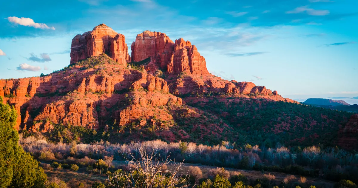
Photo by Kaileen Fitzpatrick on Unsplash
Best Hikes in Sedona: The Complete Trail Guide
Quick Answer: The best hikes in Sedona are Cathedral Rock (1.2 mi, iconic vortex views), Devil's Bridge (up to 4.6 mi, largest natural sandstone arch), West Fork Trail (6.9 mi, creekside and shaded), Bell Rock Pathway (easy, family-friendly), and Soldier Pass (5 mi, sinkhole + Seven Sacred Pools). All require a Red Rock Pass or America the Beautiful Pass.
Sedona has over 100 marked trails carved through 1.8 million acres of Coconino National Forest. This guide covers the 10 hikes worth prioritizing on your first, second, and third visits — ranked by what visitors actually search for.
Before You Hike: Three Essentials
- Red Rock Pass — $5/day or $15/week. Buy at any trailhead kiosk (credit card only) or use an America the Beautiful Pass. Required at almost every trailhead.
- The Sedona Shuttle — Free, runs Thursday–Sunday, 7 a.m.–5:30 p.m. It's the only way to reach Cathedral Rock, Soldier Pass, Little Horse, and Mescal trailheads those days because the trailhead lots close.
- Water and start time — Bring 1 liter per hour of hiking, minimum. Start at sunrise in summer, and by 8 a.m. even in cool months to secure parking.
The Top 10 Sedona Hikes, Ranked
1. Cathedral Rock Trail
The photo you've seen. The vortex everyone talks about.
- Distance: 1.2 miles round-trip
- Elevation Gain: 750 feet
- Difficulty: Moderate–Strenuous (short but includes rock scrambling)
- Trailhead: Cathedral Rock Trailhead, Back O' Beyond Road
- Coordinates: 34.8252° N, 111.7884° W
- Open in Google Maps
- Time: 1–2 hours
- Dog-friendly: Yes, on leash (but scrambling is tough for small/older dogs)
- Vortex site: Yes — the saddle between the spires
The most iconic hike in Sedona. You'll climb slickrock with hand-and-foot scrambling for the last quarter mile. Views from the saddle stretch across Oak Creek Valley to Courthouse Butte. Best at sunset (crowds are heavy but justified). Thursday–Sunday, take the free Sedona Shuttle from Route 15 park-and-ride.
2. Devil's Bridge Trail
Sedona's largest natural sandstone arch — the classic "walk out on the bridge" shot.
- Distance: 4.2 miles (via Mescal Trailhead) or 2 miles (via 4×4 Dry Creek Road)
- Elevation Gain: 500 feet
- Difficulty: Easy–Moderate (final approach is steep and exposed)
- Trailhead options: Mescal Trailhead (34.9002° N, 111.8404° W), Dry Creek Trailhead, or Chuckwagon Trailhead
- Open in Google Maps (Mescal)
- Time: 2–3 hours
- Dog-friendly: Yes, on leash
Expect a 20–30 minute wait to get your photo on the bridge in peak season. Start before 7 a.m. to avoid it. If you don't have a high-clearance 4×4, the Mescal Trailhead approach is the most scenic and the shortest walking option.
3. West Fork of Oak Creek Trail
Sedona's most magical hike. Creekside, shaded, unforgettable in fall.
- Distance: 6.9 miles round-trip (turn around any time)
- Elevation Gain: 200 feet (nearly flat)
- Difficulty: Easy
- Trailhead: Call of the Canyon Recreation Site, Highway 89A north of Sedona
- Coordinates: 34.9880° N, 111.7443° W
- Open in Google Maps
- Parking Fee: $12 per vehicle (separate from Red Rock Pass)
- Time: 3–5 hours
- Dog-friendly: Yes, on leash
Thirteen creek crossings through a towering red-and-gold canyon. Peak foliage is mid- to late October. Expect a full parking lot by 10 a.m. any weekend from September through November.
4. Bell Rock Pathway
The best easy trail in Sedona. Great for all ages.
- Distance: Up to 3.6 miles round-trip (customizable)
- Elevation Gain: Minimal (climb Bell Rock itself is optional and adds ~500 ft)
- Difficulty: Easy along the pathway; Moderate–Strenuous if you scramble Bell Rock
- Trailhead: Courthouse Vista or Bell Rock Trailhead, Highway 179
- Coordinates: 34.8102° N, 111.7657° W
- Open in Google Maps
- Time: 1–3 hours
- Vortex site: Yes — the base of Bell Rock
The paved-ish pathway makes this Sedona's best accessible-friendly option. Turn around whenever you like. Advanced hikers can scramble up Bell Rock itself for panoramic views.
5. Soldier Pass Trail
Sinkhole, seven pools, and a secret cave in one 5-mile loop.
- Distance: 4.5–5 miles (loop options via Brins Mesa)
- Elevation Gain: 836 feet
- Difficulty: Moderate
- Trailhead: Soldier Pass Trailhead
- Coordinates: 34.8892° N, 111.7793° W
- Open in Google Maps
- Time: 3–4 hours
- Dog-friendly: Yes, on leash
- Access: Thursday–Sunday only via Sedona Shuttle; other days park at the trailhead (fills by 8 a.m.)
Highlights: Devil's Kitchen sinkhole (fenced overlook near start), Seven Sacred Pools (0.6 mi in — often dry in summer), and Soldier Pass Cave (short but exposed side scramble). The Cibola Pass alternate trailhead is a good backup if Soldier Pass is closed.
6. Boynton Canyon Trail (and Boynton Vista)
Sedona's most spiritual hike. Sacred to the Yavapai-Apache Nation.
- Distance: 6.1 miles round-trip (full trail); 1.2 miles for Boynton Vista side trail
- Elevation Gain: 512 feet
- Difficulty: Moderate (full); Easy (Vista only)
- Trailhead: Boynton Canyon Trailhead, near Enchantment Resort
- Coordinates: 34.9083° N, 111.8500° W
- Open in Google Maps
- Vortex site: Yes — Boynton Vista rocks (up-flow vortex)
- Time: 3–4 hours (full) or 1 hour (Vista)
If you only have time for the vista, head 0.5 miles up the main trail, then right onto Boynton Vista Trail for a quick uphill scramble to twin rock formations with 360° views. Do not touch or climb on cliff dwellings.
7. Airport Mesa Loop Trail
Sunset views without the Cathedral Rock scramble.
- Distance: 3.3 miles loop
- Elevation Gain: 400 feet
- Difficulty: Easy–Moderate
- Trailhead: Airport Mesa Trailhead OR Airport Mesa Overlook (paid parking $3)
- Coordinates: 34.8483° N, 111.7899° W
- Open in Google Maps
- Time: 1.5–2 hours
- Vortex site: Yes — small hill visible from the overlook
The loop rings Table Top Mountain with constant views of Cathedral Rock, Bell Rock, Coffee Pot Rock, and Twin Buttes. Best sunset trail for people who want the view without the scramble.
8. Doe Mountain Trail
Short hike, huge summit plateau, minimal crowd.
- Distance: 1.6 miles round-trip
- Elevation Gain: 400 feet
- Difficulty: Moderate (steady climb, no scrambling)
- Trailhead: Doe Mountain Trailhead (shared with Bear Mountain lot)
- Coordinates: 34.9128° N, 111.8611° W
- Open in Google Maps
- Time: 1–2 hours
Underrated. The summit is a broad plateau — walk out to any edge for a different view. Excellent alternative to Cathedral Rock at sunset if you want fewer people.
9. Brins Mesa Trail
A moderate ramble that blends forest and red rock.
- Distance: 4 miles round-trip
- Elevation Gain: 620 feet
- Difficulty: Moderate
- Trailhead: Brins Mesa (west end) or Jim Thompson (east end)
- Coordinates: 34.9013° N, 111.7663° W
- Open in Google Maps
- Time: 2–3 hours
Often paired with Soldier Pass for a loop. The mesa itself opens to sweeping views of Wilson Mountain and the town below.
10. Birthing Cave (via Long Canyon)
Sacred Yavapai-Apache site with a photogenic dome cave.
- Distance: 2 miles round-trip
- Elevation Gain: 300 feet
- Difficulty: Easy–Moderate (final scramble)
- Trailhead: Long Canyon Trailhead
- Coordinates: 34.9155° N, 111.8360° W
- Open in Google Maps
- Time: 1.5–2 hours
Treat this as a sacred site — visit respectfully, don't play loud music, and don't scrape the walls. The final approach is a short but steep slickrock scramble into the dome.
Where to Get a Sedona Trail Map
- Free at any Red Rock Visitor Center — the paper Coconino National Forest map is the best overview.
- AllTrails — download the offline map before you go (cell service is spotty).
- Sedona Chamber Uptown Visitor Center — 331 Forest Road, open 8:30 a.m.–5 p.m. daily.
Trail Selection by Type of Hiker
| You Are... | Start With... |
|---|---|
| First-time visitor | Cathedral Rock + Bell Rock Pathway |
| Family with kids | Bell Rock Pathway + Sugarloaf Loop |
| Senior / limited mobility | Bell Rock Pathway + Red Rock Crossing |
| Photographer | Cathedral Rock (sunset) + West Fork (fall) |
| Long-distance hiker | Wilson Mountain (11 miles, 2,300 ft gain) |
| Vortex seeker | Cathedral Rock + Airport Mesa + Boynton Vista |
| Dog owner | Bell Rock + West Fork + Doe Mountain |
Frequently Asked Questions
What is the hardest hike in Sedona? Wilson Mountain (via First Bench or North route) is Sedona's hardest well-known hike — 11 miles round-trip with 2,300 feet of elevation gain. Bear Mountain (5 miles, 2,000 ft gain) is a shorter but steep alternative.
What is the easiest hike in Sedona with the best view? Bell Rock Pathway. It's nearly flat, kid- and dog-friendly, and gives you head-on views of Bell Rock and Courthouse Butte within the first mile.
Do I need a Red Rock Pass for every hike? Almost — every listed trail here requires either a Red Rock Pass, an America the Beautiful Pass, or a Discover Pass. The Chapel of the Holy Cross and Amitabha Stupa are exceptions (no pass needed).
Can I hike Cathedral Rock at sunset with kids? Only kids comfortable scrambling on all fours. The final 0.4 mile is exposed slickrock with 750 feet of gain. For sunset with kids, choose the Airport Mesa Loop instead.
Is Devil's Bridge really that scary? The bridge itself is 5 feet wide. If you have a normal fear of heights and stay near the center, it's fine. If you have panic-level fear of heights, take your photo from the side, not on top.
Related Guides
- Sedona Vortex Sites: What They Are & Where to Find Them
- Best Easy Hikes in Sedona for Seniors & Beginners
- Best Sunset Spots in Sedona
- Sedona Red Rock Pass & Parking Guide
- Dog-Friendly Sedona: Trails, Hotels & Patios
Plan Your Trip
Build your Sedona hiking itinerary and unlock local perks with SedonaPassport.com — the insider's pass to Red Rock Country.
Topics